
It is on the border between Bosnia and Croatia that the Cetina River rises at an altitude of 385 meters. Under normal circumstances, it would have gone completely unnoticed, but the shape and color of this source have recently made it a trending spot on Instagram (especially photos taken by drone). That was all it took for the site to be developed and for tourists to start coming to see the Cetina Eye of the Earth. However, getting there requires a detour during your road trip in Croatia, as the Cetina river spring lies off the usual routes. Where is the Cetina river spring located? How do you get there? I explain everything in this travel guide.
How to get to the Cetina river spring?
The Cetina River rises on the northwestern slope of Mount Dinara on the border with Bosnia. It then flows for 105 km before emptying into the Adriatic Sea south of the city of Split. Its location north of the tourist towns of Dalmatia places it outside the usual itineraries followed by visitors to Croatia. You will therefore need to make a detour to get there, especially since there are no notable attractions nearby, apart from discovering the Croatian countryside by following the course of the river.
The Cetina river spring is located 66 km (1h10) from Sibenik and 81 km (1h30) from Split. There is no bus service to get there, so a car is absolutely necessary. If you are not traveling with your own vehicle, I recommend using AutoEurope to rent a car in Croatia, as prices can be up to 25% cheaper.
A round trip is not necessarily worth it from the coastal towns (Split, Trogir, or Sibenik), as it’s a lot of distance for just one photo. The ideal option is to try to include it in an itinerary passing through the mountains. We managed to include the Cetina Eye of the Earth during our road trip stage between Sibenik and the Plitvice Lakes. Since we had to follow a loop itinerary during our trip, it didn’t require a major detour.
Be careful, on Google Maps there are several different directions listed to reach the source of the Cetina River. To make sure you arrive at the right destination, enter these coordinates.
Discovering the Cetina river srping
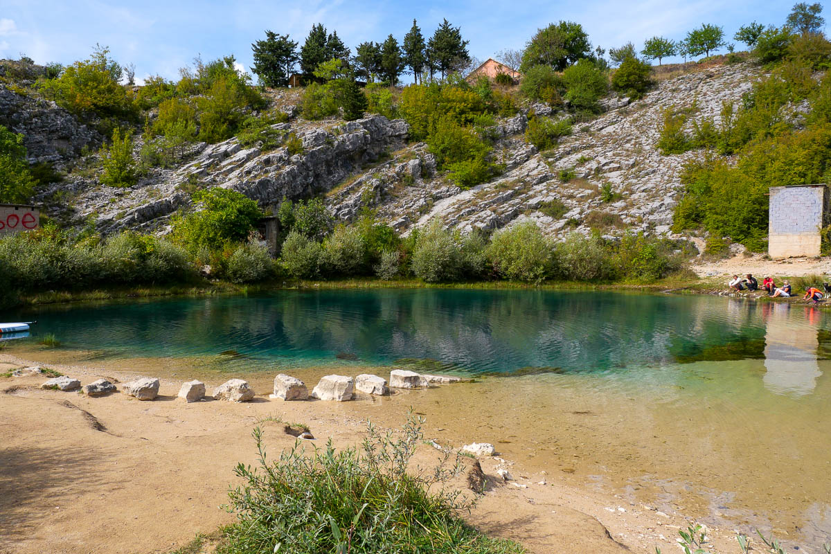
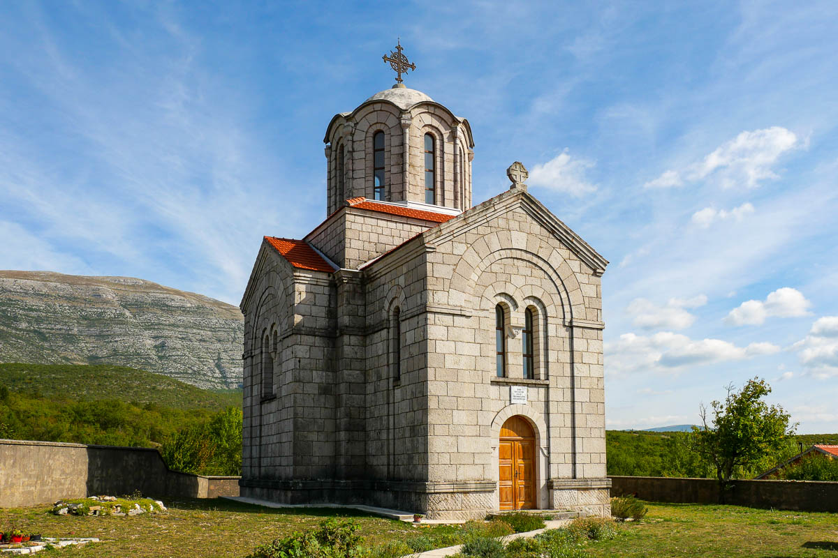
Once you arrive, there are a few parking spaces in front of a newly built wooden platform. From here, you will have the best viewpoint to observe the Cetina Eye, even if it doesn’t look as impressive as with a drone. Right next to the source, there is a beautiful Serbian Orthodox church.
From the parking area, a dirt path allows you to walk down to the Cetina river spring in 3 minutes. The place is pleasant for a small picnic. The site is not mentioned in any travel guide, but it is popular on Instagram, so you will likely encounter other tourists on site. Despite the very cold water, which does not exceed 10°C, some people don’t hesitate to get in for a photo. Those who feel the cold more take pictures on paddle boards or inflatable mattresses. You still have to be pretty motivated to carry a paddle all the way here just to show off on Instagram (special mention to the group of Germans we came across).

Drone: the almost essential accessory
To take the best photos of the Cetina river spring, you need a drone. From the viewpoint on the wooden platform, it just doesn’t look the same (you only have to compare the photos). Honestly, if you don’t have a drone to capture beautiful shots of the Eye of the Earth as it’s called, there is little point in making such a long detour to Cetina.
It’s thanks to aerial photos and videos that you can truly appreciate the beauty of this blue-green, eye-shaped source. The source is 115 meters deep, which gives it that intense blue color in the center.
In terms of equipment, I travel with the DJI Mini 3 pro, the lightest and smallest drone in the range. The photo quality is not as good as larger models like the Mavic or the Air (although it is more than sufficient for blog or Instagram photos), but its compact size was the main criterion for me. I’m very happy with it. I used it a lot this summer in Corsica, less in Croatia as it’s more complicated.


After spending about twenty minutes on site taking photos with the drone, we continued our route through the mountains to visit the Plitvice Lakes.
2 comments
Hi! Do you have one day tour from Split that includes both: Eye of Croatia and Kirk Waterfalls? If so, which kind of transportation do you provide and where is pick up and drop ou location? Thanks
Hello Martha, I don’t know of any tours that cover that kind of route. In my opinion, you should contact a private driver to arrange it (ask at your accommodation).